Pisgah, NC Labor Day Weekend RECAP

#1
Well my two riders backed out this weekend and I'm not really down for biking alone on these types of trails, so I left the bike at home and grabbed the hiking shoes and chacos.


Packed up and hitting the road at 6am


DSC_3239.jpg
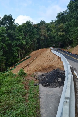
I stopped on the way up to take a look at the parkway construction where they had the massive slope failure. This is exactly what I design and try to prevent at work, so it was cool to check it out since its somebody else s problem here.:flipoff2:


All morning I had been in the fog, so it was nice to see some clear weather finally.


Then promptly back into the fog a few minutes later.​
 
#2
DSC_3244.jpg
first stop for the day was Craggy Gardens Pinnacle. This trail is slated to be closed soon, and I had never made it up there. So I figured I better try it out. There is a short option for a 1.4 mile round trip from a BRP overlook, but I chose to start at the craggy gardens Picnic area which gives you a solid 4 miles round trip. It made for a good climb and made the top worth it even more.


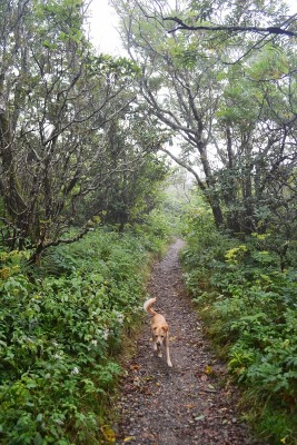
It looked like a jungle out there


This is what I was greeted with when I got to the top.

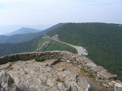
craggy-pinnacle-view.jpg
This is what it should have looked like


I caught a few glimpses of green as the fog rolled through


I snapped this one right before I started back down the trail when the fog rolled back in and I couldnt see anything.​
 

Attachments

#3

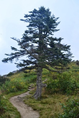
Pretty cool tree as I made my way back down.

DSC_3255.jpg
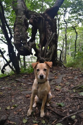
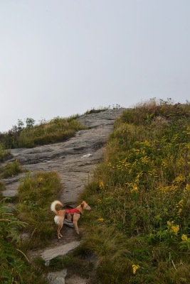
another cool tree and Roxie posing


what looks like blue sky in the background is actually fog, I was 4k feet up and I never would have known by the view.


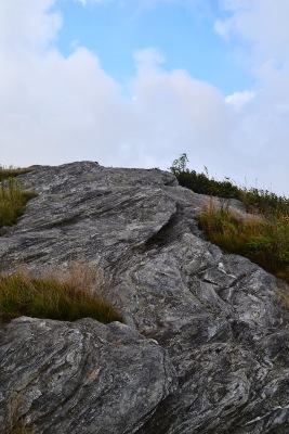
the trail winds through this rocky field


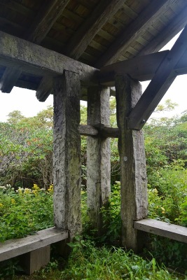
cool old shelter miles from anything

DSC_3263.jpg
very interesting to see the tool marks on these huge timbers, that took some serious work back in the day.​
 
#4

then I ventured up a little gravel road near mount pisgah that a few of us had found years ago on spring break. I wanted to check out the old missile silo again.

DSC_3266.jpg
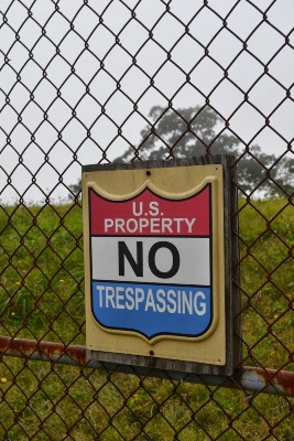
I'm not sure what it really is, but its obvious they don't want you climbing on it.


whats hiding down there?​
 
#5

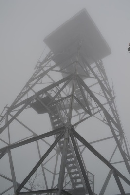
Next stop was Frying Pan Tower. Its a short 2 mile or so hike round trip on a gravel service road.


as I got farther up the trail I could see the tower. This road is in great shape, and I assume they keep it gated to keep the graffiti and ravers out.

DSC_3275.jpg
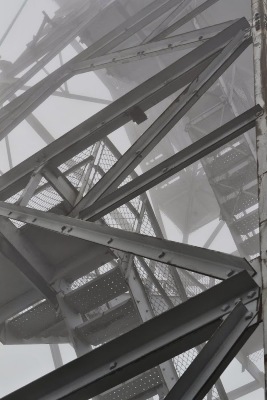
Now its easy to say you are going to climb it.... but when I got there and I was by myself, and it was so foggy I couldnt hardly see the top...it was a bit harder decision.


3 flights up and Roxie said thats as far as she was going... I didnt blame her and I turned around too. I couldnt see anything but fog anyways. I'll have to return on a clear day with backup.

DSC_3278.jpg
The tower is 70 feet tall and was built in 1941. A tribute to American engineering!​
 
#6


grabbed a geocache on my way back down from the tower. There is a webcam on this mountain that views cold mountain. The geocache requires you to go and stand in front of the camera till the webcam refreshes and have someone screen shot the webcam. I called up Andrea and she pulled it up for me. Here is a picture of the camera on the side of a weather station.
 
#7
I made my way over to black balsam and ate some lunch and took a nap in the hammock while I waited for the fog to roll out.

DSC_3280.jpg
Later that afternoon I started on the art loeb trail at black balsam. This is one of my favorite hikes in Pisgah.


Roxie was super excited to be out on the mountain, she kept coming back to me and sitting like this trying to get me to go.


the trail winds through rocky out croppings and over the ridgeline for miles


DSC_3288.jpg
some of these might be interesting in the rain...​
 
#8

The fog rolled through the area, there were times I couldnt see the trail in front of me 20 feet, and then it would clear up, then back to fog.


DSC_3293.jpg
as I got to the top of this ridge it looked like it was going to clear up!


for a minute...then it was more fog at the next hill


less than stunning view from the Art Loeb marker on black balsam​
 
#9

usgs marker on the top of one of the balds


I was the only one out there, which was a first for me, and the fog was rolling through, it was a bit eerie.


It doesnt get any better than this!​
 
#10

it was starting to get dark and I needed to get back to camp before the rest of the crew got there for the night. So I made my way back towards Bent Creek.


I stopped to grab a good sunset picture at one of the few places you could see through the fog.


not much of a sun set as the clouds had blocked most of the sun.


#11
Saturday was a new day with more fog, we were moving more and I didn't get as many pictures, but we had a great time at the NC apple festival and wandering around here are some from saturday.


more fog! but not as much as yesterday


The crew


stopping to take in the sights along the Blue Ridge Parkway


camp packed up sunday and ready to head to Asheville for breakfast.


on the road again. Had a great time, and I'm looking forward to our trip in October.​
 
#12
Hate ya didn't get to ride. I was curious how you liked the climb up Ingle Field Gap and back down Greenslick. With my brother being kinda new I didn't get to drop down it. I was ready to crank my front fork to 130mm and bomb down it. How's the BRP construction coming? Was it open at all? I'm headed back up there this weekend to camp and it would really save me some time if I could get on it.
 
#13
The Ingles Field Gap trail isnt so bad of a climb because you know you get to go down greens lick when you get to the top, I usually come up sidehill to ingles field to 485 to greens lick, then come back sidehill to little hickory top.

All the BRP construction is open through the fall. It opened August 26th in time for labor day. They are going to do the real fix over the winter.
 
#15
You should check out Black Mtn campground. It's not in Black Mtn so don't be mistaken by the name. It's ruffly an hour north at the base of Mt Mitchell. First come first serve primitive camping. 40 or so sites that are very nice with nice clean shower houses. A couple miles up a dirt road along ways from town. It's right on the south toe river. A hand full of hikng trails lead right out of the camp ground. You can head 5 miles up a dirt road that has tons of primitive sites on diffrent creeks and at the top is the BRP, take a right and ride 8 miles up to Mt Mitchell. My parents brought their 35'ft fifth wheel and dually in there just fine and primitive camped a few weeks ago. So that give you idea of how big most sites are. It's quickly became my favorite place to camp. Mid 50's at night, mid-70's to 80's during the day.
 
#16
Yup, that is a pretty cool campground. we wanted to be a bit further south this trip because we were going to the apple festival in Hendersonville on Saturday. We stayed there on our east coast adventure in 2011 and enjoyed it.

http://www.offroadsc.com/showthread.php?46-East-Coast-Adventure-May-2011

We stayed at lake powhatan campground on this trip and we were able to put up both tents in the single site for $21 per night. They also have some of the nicest bath houses around.
 
Last edited:
#17
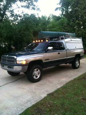
I'm headed back there this weekend. My girlfriend has asked twice this week if we were going. She loves it there. Puts up her hammock and reads till she falls alseep. I'm fixing to start a build thread on my old dodge. I'm gonna fully convert the back of the truck to better suit camping with a/c, shower and am awning off the side.
ImageUploadedByTapatalk1378232382.771545.jpg
 
#19
Awesome trip and some great pictures. I've been looking at the thread for the October trip and I might have to get a move on for my gear cause it looks like you plan some awesome trips dude.
 
#20
Finally looked at these pics from a computer. Looks like a great time and great pictures.

How did larry's camper do? Any pics of it set up?
 
Top